Thursday, August 14, 2014

Fauna on the Kaibab Plateau

A break form our camp hosting duties for an anniversary lunch at the Kaibab Lodge came with a bonus this week.  In the span of just a couple of miles we spotted a slug of wildlife.  One in particular we were excited to see were wild turkey.  We have been scouting for turkey in all the places we frequently saw them last year with no luck.  On this day there were two hens, each with a brood right alongside the main highway, just outside the entrance station to the North Rim of the Grand Canyon.


Even though I was about 300 yards away, this hen was keeping an eye on what I was doing.
Cyndee is a great critter spotter.  This comes in most handy when we are making the 25 mile drive between Jacob Lake and just past the entrance station.  This road is thick with deer along the entire length and buffalo in the last five miles from just outside the entrance station to just inside.  If you are driving this road in the twilight or dark hours it is treacherous.  It is 25 miles of a white knuckle game we call deer dodge.  Cyndee sees the faintest thing that looks like it could walk in front of us and keeps me from doing something expensive.  But in the middle of the day she puts these skills to work spotting animals that we can photograph.

For the shots of the turkey I was just boogying down the road anticipating indulging myself in a plate of hot wings when Cyndee exclaimed "Turkey!".  I had to drive to the next turnout so I could get Big Gulp turned around and go back to where I could get within the range of my lens.  A few minutes later and were back on our way to lunch.  Just a few hundred yards from the turn to the Kaibab Lodge Cyndee says; "Hawk!".  And again I had to turn around to get back to within range.  Although in range may be a matter of opinion.  Even with my zoom lens maxed out at 300mm the bird was just barely visible in the viewfinder.


With some cropping and enlarging I could get a fuzzy portrait of a Red Tail Hawk.  At the time, we were so far away we could not tell what the hawk was up to.  Maybe it was resting, maybe it was watching for its mate or maybe it was scouting for prey.  We were just too far away to tell.  So we hung around for awhile to see if anything changed.


But nothing did, just a whole bunch of pictures with the head in different positions.  We were so close to the Kaibab Lodge that I could hear those hot wings calling me so I took one last shot before starting the truck and getting back onto the road in the direction of lunch.


Wouldn't you know it.  The camera was put down, the truck running and I was starting my turn onto the road when the hawk dropped off his perch and dived directly in front of us, just feet away.  Within three feet of the ground he flared his wings and a burst of sparrow-size birds rose out of the grass.  In the blink of an eye the hawk was doing aerial aerobatics and knocking one of those little birds loopy and then taking it in his talons and flying out of sight.  It would have made for some great shots but I did not even have time to let go of the steering wheel let alone pick up the camera and get it focused on the action.  If we had waited just thirty more seconds before heading to lunch I would have had shots of a lifetime.  Darn those vocal hot wings.

We really enjoyed our anniversary lunch and the hospitality of the folks at the Kaibab Lodge.  On our way out we went across the road to the country store to say high to the two couples that run the place.  It is also the only place within 85 miles we can get a 20 oz Coke Zero in a bottle.  Having touched base with friends and Coke in hand, we headed home to the North Rim.  This time the critters were easy to see from a great distance, even while I was driving.  Three mule deer bucks, just grazing near the edge of the road.


These guys were a little more wary than the turkey.  My stopping made them uncomfortable and they decided to move on, and into the dark woods.

It is only August and these bucks already have large racks, and still growing.  The velvet was thick and shiny.
 Something that we saw on the way out and wanted to take a closer look at on the way back was a truck off to the side of the road with front end damage.  We have been hearing reports of numerous deer and buffalo strikes in the past few days and were suspecting this was the aftermath of one of those.  And boy was it.  This was no collision with a deer, it had to be a buffalo.  See for yourself.


This was no light contact encounter, a buffalo was hit broadside at speed.  The truck will probably be a total loss but the buffalo lost its life.  That is at least four buffalo in the last two weeks and another half dozen deer.  People come through the meadow, sometimes at double the speed limit, in the pitch black of night.  The deer are hard to see, the buffalo with their dark coats are essentially invisible.

The herd is now gathered up around a near-dry water hole (in the background) just inside the entrance station.

So far each of the collisions have been with cows that have had one or two calves.  The park practices a no interference policy and the calves are left to make it on their own, or not.

Wednesday, August 13, 2014

Point Sublime, Well, Almost.

Point Sublime is a scenic overlook that is approximately 18 miles west of the North Rim Campground.  But unlike the other scenics you can drive to on the north rim of the Grand Canyon, the road to Sublime is not paved.  It is 18 miles of rutted, rocky, high clearance dirt road.  But the payoff for an hour of bumping, jolting and dust eating is a view worthy of its name.


Keeping with our goal of getting out and seeing the sights this year instead of spending most of our time in the campground, Point Sublime was high on our list.  We would have been out to this point long before now but as luck would have it, the last weekend in May there was a lightning strike that started a fire that burned for weeks and kept Point Sublime Road closed for all of June and July.  But it is open now and we are on our way.

Eighteen miles does not sound all that far, but when it is a rough dirt road and an average speed of 5 mph (not to mention stopping every few minutes to take pictures), it was well over an hour to get to our objective.  But the slow going was okay because the scenery was so great.  We alternated between flower-filled meadows, forested ridges and valleys and buffalo wallows.

One of the meadows.  If it gets even a little bit wet, this place turns into a vehicle swallowing mud hole.  Hard to see in this wide shot but the lupine is thick out here.
A little closer look begins to reveal the lupine that is just about carpeting the meadow.
I have photographed a lot of lupine in and around the campground but nothing I had seen so far had been this colorful and perfectly shaped.
There is one high ridge to cross over on the way to Point Sublime.
Up on the ridge, sunny spots are peppered with wild flowers.

Being in the arid climate of the southwest and at an elevation that experiences wicked winters, it is always a surprise to see sections of forest with lush growths of ferns.

The fire took its toll on a downed ponderosa pine but vegetation has rebounded  with a flourish.
After what seemed like a long time and a long way we came to a turn-out.  Finally, Point Sublime.  A check of the map confirmed that we were at the terminus of Tuna Creek Canyon and the rock outcropping that formed the point, although I was having trouble reconciling not seeing several roads that, according to the map, we should have intersected by this point.  But there were rocks to climb and trails to hike.  We can fiddle with the map when we get home.

If there is an edge, I have to get on it.
Tuna Creek Canyon at about 11:00 am


Most of the Grand Canyon is restricted to low flying aircraft, no fly zones are painted all over maps of every kind.  At the North Rim Campground it is a rare day that anything can be heard flying overhead and when you do it is usually a park service helicopter either making a medical run or dignitary transport.  But the canyon in the above picture is open to tourist flights.  In the short time we were at this spot there was at least a sortie of fifteen helicopters every thirty minutes.  You could hear them long before you could see them.  They would approach from the south rim, deep in the canyon and then follow Tuna Creek up its canyon, half way between the rim and the bottom.  Then, just as they approached the end of the canyon they would point their nose up and follow the contours of the canyon wall up and over the rim, turning back to the south and out of our sight.

 
So here we are, 10 miles or so from any visible water source, on the edge of a 2,000 foot deep, sheer walled canyon, nothing but thorny scrub brush under a low canopy of conifers.  We are walking around seeing the sights and taking pictures and what do you suppose we have to watch out for so as not to step in it?  Buffalo poop!  Everywhere we walked, even right to the very edge of the canyon was covered in buffalo patties.  All my life my only idea of buffalo habitat was large herds grazing on or thundering across the vast plains of the mid and southwest.  I have now learned that there are two species of buffalo, the plains bison and the wood bison.  And much to my surprise, the plains bison is the smaller of the two.  So it would seem that we have a herd of wood bison with us here on the north rim of the Grand Canyon.

Knowing that we were going to be out in the back country at lunch time, we packed ourselves a picnic lunch to eat while at the point.  It worked out pretty good as there was a place to back up the truck, let the tail gate down and use it for a table.  I had thrown in a couple of camp chairs so it made for a pretty comfortable lunch.

How's this for an al fresco dining view?  The canyon looks pretty good too.
A few more shots of the canyon, this time from the west edge and then we'll head back.


What kind of a post would this be if I didn't do a panorama?
Buffalo are not the only critters that hang out at the point.
Now that we have finished play time and are ready to go back to the campground I once again turn to the map that made me scratch my head.  There should have been a 'Y' in the road that we could use to go north and come out on the main road to the park at the entrance station.  Was it so faint that we missed seeing it coming in?  I took some measurements on the map and calculated exactly how far back in the direction we came that the intersection should be.  Then I set the trip odometer to zero (something I probably should have done the minute we started this trip) and headed back to the east.

In 5.2 miles we should see a connecting road heading north through the woods.  At the appointed mileage we are in a place that there is not even the slightest hint of another road or any indication that there has ever been another road.  This map is seriously messed up.

We continue on and in a little less than an hour we are back at the sign saying "Point Sublime 18 mi".  I look at the trip odometer on the truck and it says 10.2.  Instant realization, there was nothing wrong with the map, the map reader totally blew it!  After a whole day of thinking we were at Point Sublime we were not even close, a whole eight miles short of our desired destination!  I am going to have to sign up for remedial map reading.

So none of the point pictures above are Point Sublime, they are an unnamed rock outcropping at the head of Milk Creek, not Tuna Creek.  I wouldn't call the day a total loss but it sure was disappointing to figure out I hosed up the map reading so bad.  On the bright side, I have a good reason to go back out there again.


Saturday, August 9, 2014

Its back! Thank goodness it is back.

By the end of June the work horse of the camp host job, our all electric ATV, had no tread left on the tires and the brakes had worn completely through the caliper pads and the caliper pistons grinding on the rotors was all that was stopping us.  We had told the people responsible for maintenance of this equipment that it needed work done on it last September, but with the government shutdown on the 1st of October everything went to the wayside.  Even when the government re-opened a couple weeks later it did not matter because the North Rim was shut down for the winter and all but a skeleton crew had been furloughed until May of this year.

Aside from Cyndee, the ATV is the hardest working member of the camp host crew.
On the first of July the ATV was just not possible to drive anymore.  It was finally retrieved and dispatched to St. George, UT, 3 hours away, for much needed maintenance.  The guys that took it had hopes that they might return with it the same day.  I knew that was a pipe dream, there was just too much to be done.  They would not even get it to the shop before noon so that meant that all repairs would have to be done in less than two hours so that they could make the three hour drive back to the north rim before their shift ended at 5:00pm.  Never going to happen.

Cutting to the chase, it was more than two weeks before they even started to work on it and then there was the multi-week wait for parts.  That could have been a shorter wait but they ordered the wrong parts (it needed new rotors, which they don't keep in stock) and had to start all over.

But in the interim we used a gas powered ATV that belongs to the law enforcement group.  I don't want to seem ungrateful but there is no other way to put it, this thing was a dog!  Being gas powered it was noisy, it stunk, it rode rough (super aggressive off road tires) and engine heat pumped directly into the cab, scorching our legs.  Making rounds at six in the morning and quite hour checks at 10:00pm became impossible.  We were the noisiest thing on the north rim.  Non-fire pit cleaning rounds were done on foot now.  Good exercise but added lots of time to getting the job done.

Then, as if an answer to prayers, the engine light came on and the LE guys were quick to recover their back roads patrol vehicle.  We moved on to the next vehicle down the line, our 16 year old Dodge Dakota pickup with giant ash cans in the bed.  No more scorched legs and significantly quieter.  But significantly larger too.  Moving through the campground and getting in and out of campsites got a lot slower.  A much improved working environment but still a slow go.

Cyndee, I and our co-hosts hounded the guys every day about when the electric ATV would be back.  Even after the repairs had been completed we could not get it back up on the plateau.  Everybody they thought was "qualified" to make the trip to St. George were not available or had scheduling conflicts.  Finally, after days of pestering them and getting them convinced that we were fully qualified to drive a pickup truck and pull a one thousand pound trailer (our pickup weighs nine thousand pounds and our trailer weighs twenty-two thousand pounds - duh!) they gave in and told us to go get it.  They did not have to tell us twice, we were off.


Backed up to the trailer and connecting the hitch.


Getting this show ready to go on the road.


One last walk around to be sure the tie-downs are good and tight.


Saddle up Cyndee, we are out of here.
That poor old truck has been around the block few times.  In addition to being 16 years old it has 160 thousand miles on it and has been modified six ways from Sunday to do duty as a police cruiser, back roads patrol vehicle and now as a visitor assistance/traffic control cruiser.  The shotgun and assault rifle mounts are still bolted into the inside of the cab, they're empty, and the big two-way radio and bubble-gum machine light system are still in place and functional.  The siren control box and electronics are still mounted to the dash but they are not hooked up to anything.  A pop of the hood and a peek in the engine compartment reveals a rats nest of after market wiring for all the gadgets inside.  Why explain all this you ask?  Well, all of these factors contributed  to us not getting home without incident.

We had no more pulled away from the Polaris shop than the idiot light for the battery came on.  Typically that is an indication that the alternator has quit and the battery is the sole source for all things electrical.  It was getting late and it was wicked hot, we had three hours of driving to do and we needed the air conditioner and we were going to have to use lights.

Lucky for us we were driving down a street that had a few repair shops on it.  I pulled into one just as they were closing up for the night.  The owner said he would not be able to do a repair but he would at least put a meter on it to see if he could tell what was exactly going on.  Like me, he expected the alternator to have quit but it turned out to be the opposite.  The battery was getting hit with 17 volts, that's enough to deep fry a battery pretty quick.  Rather than having to worry about turning off everything electrical, the mechanic said that we should turn on every single thing we could to draw down the voltage.  Looks like we will get home tonight, limping in on a burned out voltage regulator.

Man is it good to have the electric ATV back in service.  Our efficiency is much improved and we are keeping up with all the chores again.

Friday, August 8, 2014

Farewell to Our Co-Hosts of the Grand Canyon North Rim Campground

Typically the summer season of the North Rim Campground (May 15th thru Oct 15th) is divided into two halves for campground hosts.  Last year we had the second half, August until the end of October.  But the government shutdown cut us short almost 30 days.  This year we were asked to work the whole season, and then some, coming in early May and staying until the end of Oct or until snow falls, whichever comes first.

But our co-hosts, three year veterans of the North Rim, signed up for the first half and the time has come for them to return to southern Arizona and their grandchildren and great-grandchildren.  To wish them bon voyage the rangers in the fees group (the group that the camp hosts work for) put together a pizza and roasted marshmallow get together.

The monsoon had begun on the 4th of July and the weather had been pretty sketchy for these last days of the month.  We were not sure if we were going to get rained out or not but we planned our outdoor/campfire party as if the weather was going to be perfect.

Cyndee and I were on duty the evening of the farewell party but our supervisor said we WILL take time out for a slice and s'mores.  It was our night to work the closing of the camper registration desk, she had us shut down an hour and a half early.  She even closed the entrance station, fifteen miles away, early so the ranger out there would be able to get to the pizza before it was all gone. The skies were darkening as they had a tendency to do this time of day but we pushed on.

When the time came the campfire was burning perfectly, the pizzas were hot and fresh (from the Deli in the Pines, a mile away at the lodge) and marshmallows at ready.

Our co-hosts; the Santa Claus in the T-shirt and shorts and his wife, closest to the camera in the green jacket.

That's Cyndee, standing in uniform.  Everybody else was off for the evening so no other uniforms to be seen.
In the pictures above, for the time of day it should have been bright shafts of light streaming in from the west with the ponderosas casting long shadows.  Instead, we were bordering on needing a flash to take the pictures.  Clouds were darkening and the temperature was dropping.  Cyndee was poking me to come on and go get all the late arrival permits posted lest we end up doing it in the rain.  I complied but not soon enough.

We had no more started hanging the first permit than the skies opened up.  We made a short loop around the top of the campground and passed by where we had been roasting marshmallows moments before.  As best we could tell, eight people had piled into our co-hosts 5th wheel and continued the festivities.  Or as much as you can in less than 400 sq. ft.

We had a larger number of late arrival permits than usual because we had closed the registration desk early.  By the time we got done we were soaked to the bone but we were also still basking in the glow of a delicious slice of pizza and perfectly roasted marshmallow and fond farewell to our partners in camp hosting for the last 10 weeks.

Grand Canyon, North Kaibab Trail - Its about time!

Hard to believe, at least for me, that we have been up here on the North Rim of the Grand Canyon for our second summer, almost six months of living on the rim, and we have yet to set foot on the most famous trail of the north side.  The North Kaibab Trail is the only trail (actually there are a couple others but they do not connect to the south rim trails) that makes it possible to walk from the top of the north rim to the bottom of the Grand Canyon and ultimately connect to one of two trails that can be climbed to the top of the south rim.  It is high time to fix that.

The National Park Service website describes the North Kaibab Trail as "The least visited but most difficult of the three maintained trails of the Grand Canyon."  From our campsite in the campground it is just under a mile walk to the Kaibab trailhead.  A relatively flat hike all the way to the trailhead but once you set foot on the Kaibab Trail there is no mistake that the trail is steep.


The above image is a cross-section of the canyon wall where it intersects the North Kaibab Trail.  There is no exaggeration of the steepness of the canyon wall, the trail is just one switch-back after another.  While it is only one mile straight down to the river, the trail winds you back and forth across the face of the cliff for fourteen miles to get you down to the Colorado.  Visitors are strongly advised not to attempt a hike to the bottom and back in one day.  Of course many do not heed this warning and that is what keeps our search and rescue/EMS people gainfully employed and on overtime most days.  My hike in is going to be about as short as it can get.  I will make my way down to the first named overlook, the Coconino, and then start back.  In the above image that is barely down to the second layer of rock, the brown layer just below the grey one at the very top.

***Fun fact***
The top layer, the white one, is called the Kaibab formation and it is a limestone.  Geologists tell us that it used to have several thousand feet of sandstone layers above it at one time but they were soft and eroded away.  The Kaibab limestone, being a hard formation is the reason that the Grand Canyon looks the way it does today.  The hard limestone has protected the softer layers beneath, slowing erosion and giving us the steep canyon walls instead of a sloping alluvial plain.

All total it will be about a mile to the trailhead and a mile into the canyon and then back for a total of just under four miles.  For people with healthy knees this short of a trip is not hardly worth getting out of bed for.  But for me it will be a test of how well all the walking I have been doing in the campground is benefitting me, or not.

The trail from the campground is a combination of walking on the Transept and Bridle trails to the Kaibab trailhead.  For the most part you are cutting through dense ponderosa pine, but just before getting to the trailhead the Bridle trail pops out of the forest and parallels the main road coming into the North Rim. 


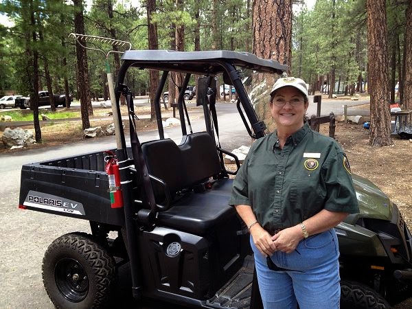
There is a parking lot adjacent to the main road that holds about 50 cars but every day there are way more than 50 vehicles parked for access to the Kaibab Trail.  People are crazy, they will park 30-foot long 1-800-rent-me RVs alongside the road, hanging one set of wheels off the edge of a cliff rather than use the parking lot at the campground and walk a thousand yards.  Some of them get so twisted up parking on the uneven shoulder that they can't even open their cabin doors.  You see people climbing over the front passenger and driver seats to get in and out of the cab doors.

However, those "in the know" know to get to the trailhead before 7:30 in the morning.  Not because of parking but because that puts you on the trail before the mules head out for the day.  And believe me, you want to be in front of the mules, not behind them.  I don't know what they feed those things but they leave the stinkingest mess on the trail you have ever experienced.  And this is not coming from a city boy, I have mucked stalls and corals and these mules leave a far more unpleasant "deposit" than anything I have shoveled before.

The trailhead is marked with several information/bulletin boards, lots of warnings about its steepness, ruggedness and long distances between water sources.  Thousands pay attention and prepare, ultimately having the hike of a lifetime.  Every year a dozen or two do not and go home zipped up in a black bag.  You would think that with such a reputation the trailhead would be this big deal but it is quite the opposite, just an unceremonious, rough-shod gap in the trees that goes down.


Technically, the Kaibab Trail is not in the Grand Canyon, it is in a side canyon known as Roaring Springs Canyon.  It is home to the Roaring Springs which is the sole water source for both the north and south rims, providing water for 5.5 million people a year.  It's a big spring.  The spring is down about 3,000 feet vertically and almost 5 miles of switchbacks.  It is a pretty cool sight to see but I won't be going that far today.

It is a little after 7:00am and I am entering the trail.  It is cool in the shade and warm when on a section of switchback that is exposed to the sun, even this early in the day.  No sign of the mules so it looks like I am ahead of the game.

In this top section of the trail the trees are pretty thick and getting photographs of great vistas are hard to come by.  But you do get little peeks of Roaring Springs Canyon here and there.


Dropping down and moving across the face of the cliff the vegetation begins to thin out and better views present themselves.

 
Even when the view begins to open up your line of sight is still limited to just Roaring Springs Canyon.  However, way off in the distance is the South Rim and you can just make out Humphries Peak near Flagstaff.


At this point I am about 500 feet below the rim and have negotiated about a half mile of switchbacks.


Then, in what seems no time at all I see the maker for my objective, Coconino Overlook.


Wow, that seemed awfully easy.  I was not wearing a watch but my perception of time was that I had been walking about ten minutes.  It had to be longer than that, I don't do ten minute miles walking plus I had stopped several times to do photography.  Oh well.

Below are a number of shots from the overlook.  It is pretty but we have been to other and there are more spectacular places down the trail.


Now I am scratching my head.  It was a breeze walking to this point and I know that just another mile down the trail is Supai Tunnel, a much more photogenic place.  But that mile of trail was pure switchbacks of another 600 feet of vertical drop.  I was tempted but I kept looking back at that trail I had just descended and thought better of it.  I should stick with my plan to test how it goes in BOTH directions before adding on a doubling of distance.
 
Good thinking.  I had no more started back up the trail and was surprised at how labored my breathing was.  Unlike the coast down the trail, I was working now.  Knees felt great but the lungs were complaining.
 
One thing about the strategy to get on the trail before the mules is that it works perfect if you keep moving down the trail.  If you just goes down a ways and then head back up, then walking in the mule's wake is unavoidable.

 
The above pics are my first of three mule encounters on my walk out.  Each time there were seven mules and as best I could tell they all seemed to use the same section of trail to do their business.  But that section was long enough that you couldn't hold your breath and squint you eyes long enough to get past it without burning your nose hairs and making your eyes look like you were coming down off a three day drunk.
 
Regardless, it was a great test-hike and I have a much better appreciation for how easy it is to over-reach ones ability.  Next trip; Supai Tunnel.