 |
| El Malpais, New Mexico |
The move from Ft. Sumner to Milan went really well. Since leaving Granger Lake we have only been using secondary state highways and county roads, no major highways or interstates. There have been a few miles of rough road that is long overdue for repaving but overall a very good driving experience. The new truck is performing well. It is fuel hungry though, not yet broke in at little more than 10,000 miles. Between the wind and the ever increasing elevation, the mileage is running about 8.5mpg. Cyndee's little SUV pulling the equally little cargo trailer is getting 20+mpg. Of course we have been using her SUV to do all our grocery getting and sightseeing so it is racking up the miles out here in the wide open west.
So, for this post I am forgoing a lot of narration and just posting a bunch of pictures. We saw so many beautiful sites and there were so many pictures.
El Malpais
 |
| El Malpais National Monument Visitor Center. |
 |
| El Malpais |
 |
| El Malpais |
 |
| El Malpais |
 |
| El Malpais. This is as close as Cyndee will get to the edge. |
 |
| View to the east from El Malpais |
 |
| Me on the other hand, right to the edge. |
 |
Our first of many crossings of the Continental Divide this trip.
Elevation 7,882 |
 |
| El Malpais |
 |
El Malpais, La Ventana Arch
You have to squint your eyes to see the arch in this two dimensional
representation. |
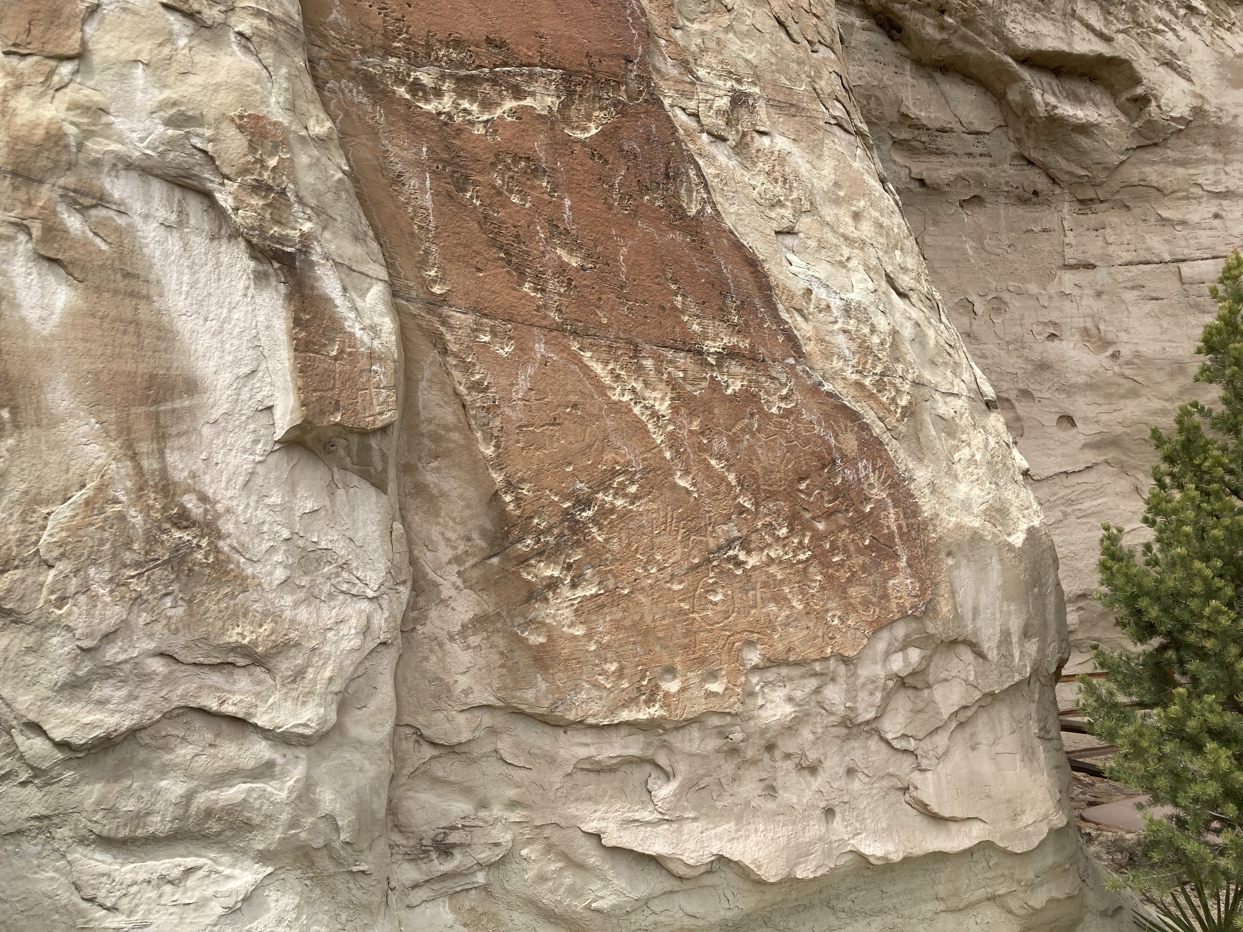
El MorroEl Morro is on the other side of the valley from El Malpais. Its claim to fame is its petroglyphs.
 |
| El Morro National Monument Visitor Center |
Access is very controlled to this ancient history. Paved walkways are to be used and not deviated from.
 |
El Morro.
Foot bridge approach to petroglyphs |
 |
Gopher Snake
Ran across this fellow at the entrance to the foot bridge.
So far our only encounter of the snake kind. |
 |
| El Morro |
 |
Pour off at El Morro
This must be quite a sight when it is raining. |
 |
| Some of the more ancient glyphs |
 |
| Telling the story of bighorn sheep |
 |
There were also carvings of Spanish Conquistadors and
early settlers. |
Aztec
 |
| Aztec Ruins Visitor Center |
 |
| A reconstructed kiva on an ancient foundation |
 |
Some of the best preserved examples of tri-wall construction.
A building with a wall within a wall within a wall
with these small, almost crawl spaces to get from one to the next. |
 |
| A kiva, one of several at Aztec |
 |
| A kiva and dwellings of a once thriving city |
Chaco Canyon
 |
You really have to want to go to Chaco Canyon to tolerate
15 miles of dirt road with severe washboard, ruts and rock outcroppings.
It took us an hour, each way, just for the dirt road portion. |
 |
Once inside the park boundaries things become civilized again.
Paved roads, visitor center, electricity and water. |
 |
| A couple hundred feet of cliff broke off and fell on the ancient dwellings. |
 |
| What can I say? I just liked the way the light looked. |
 |
| That's Cyndee taking in one of the massive walls that remain standing. |
 |
Chaco Canyon's Puebloan structures have numerous and large windows,
not all that common amongst these structures. |
 |
| Lots of kivas (the round structures) in this huge dwelling. |
 |
| Thousands of people once lived here. |
 |
| Massive walls to support a sometimes 3-story structure. |
 |
| Another example of a tri-wall construction technique. |
 |
| Fajada Butte as seen looking south from the dwellings. |
 |
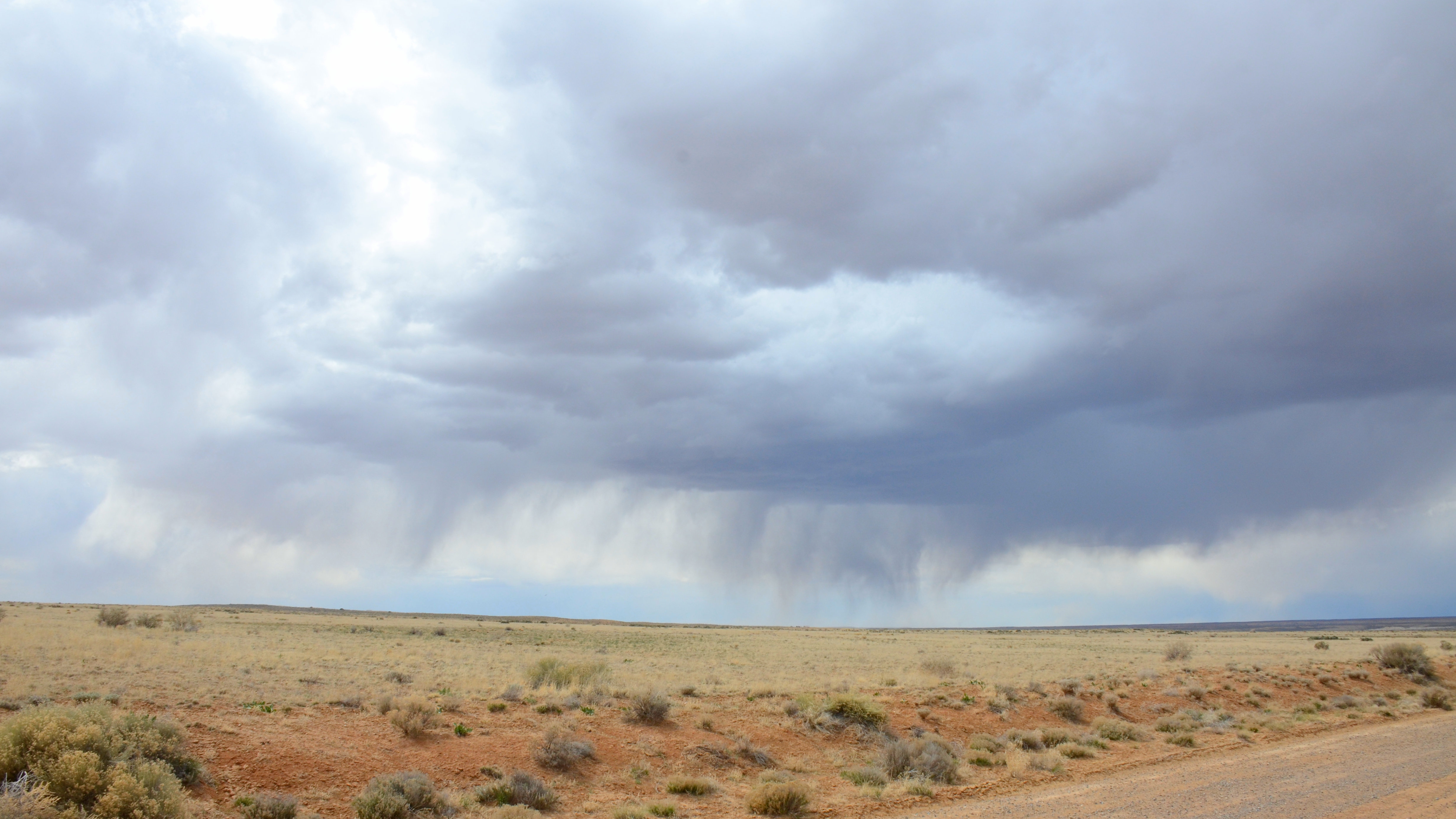
Our day in Chaco Canyon ended as it began with a little
drama in the sky. |
Well folks, that's New Mexico for us. We're headed for Colorado next. We've got our sights set on a casino RV park in Ignacio, CO, about 17 miles from Durango.


J & C as usual, your pic are great and interesting, you guys certainly have adventures! Good to hear the new truck is going well. Yes, besides being thirsty, the price of diesel up this way is quite heavy.
ReplyDeleteAbsolutely beautiful thanks for sharing your journey. Always enjoy your posts very captivating. God's speed on your continued travel.
ReplyDelete